
Wildland Fire Risk Assessment
The Tualatin Basin Wildfire Risk Assessment is a collaborative project in which the Tualatin River Watershed Council, the Tualatin Soil and Water Conservation District, Clean Water Services, and the Joint Water Commission characterized the potential impact of a wildfire on drinking water quality in the Tualatin Basin.
This risk assessment is the first phase of a greater wildfire preparedness plan within the Tualatin Basin and Washington County. The purpose of the assessment was to identify locations and potential treatment areas in which we can focus our resources to better safeguard source water quality and critical water treatment infrastructure in the event of wildland fire.
Subject matter experts from OSU Extension and Wildland Fire Associates led the analysis and provided recommendations in the report with support from the US Forest Service and Oregon Department of Forestry. The analysis in the assessment is based on the modeling framework in the Pacific Northwest Quantitative Wildfire Risk Assessment (PNW QWRA). Our partner group identified a set of highly valued resources and assets (HVRAs) to inform the modeling for this assessment and focus the recommendations on water quality protection.

Our organizational partners at the Tualatin Soil and Water Conservation District managed the project. Prioritization and action planning relating to this work is ongoing.
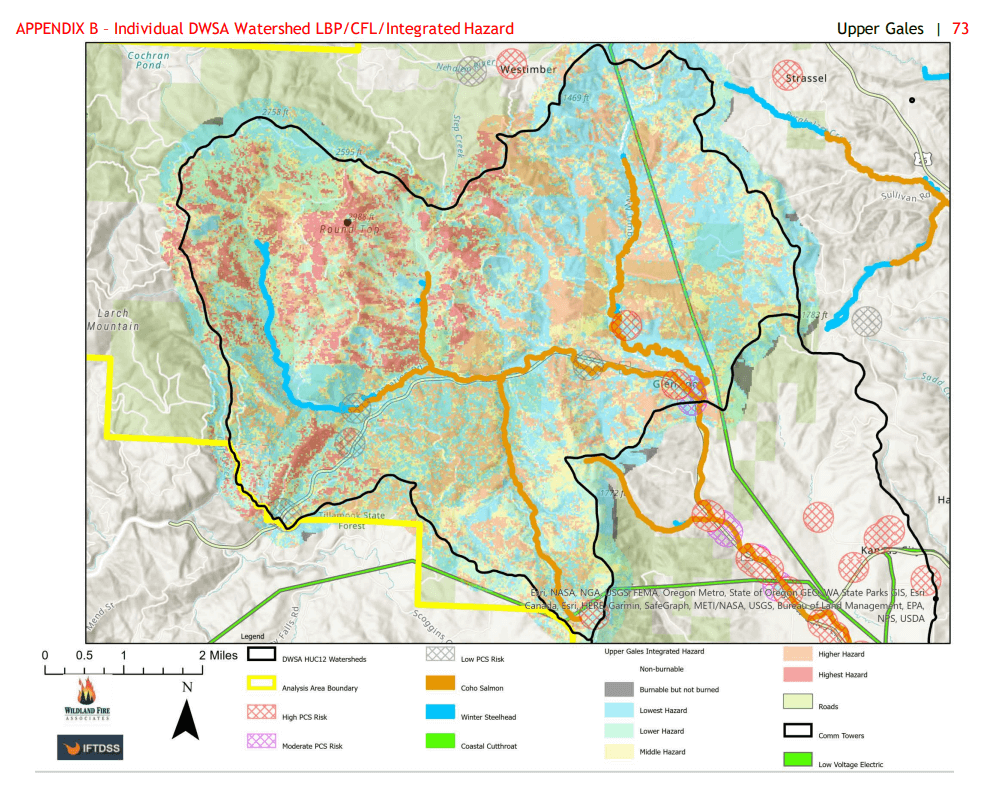
Two sample maps for Burn Probability and Integrated Hazard are featured above. View the full report and all maps here.