
Learn
Watershed Maps
Calling all visual learners! Come visit our map library to explore Tualatin Basin soils, elevation, and data galore.
In addition to the interactive watershed map, our map collection features baseline information like soils and geology, location of cities, and ecoregions, as well as more specialized maps displaying instream data collection.

Interactive Watershed Map
Use our interactive map to take yourself on a self-guided tour of the watershed.
View MapAll Maps
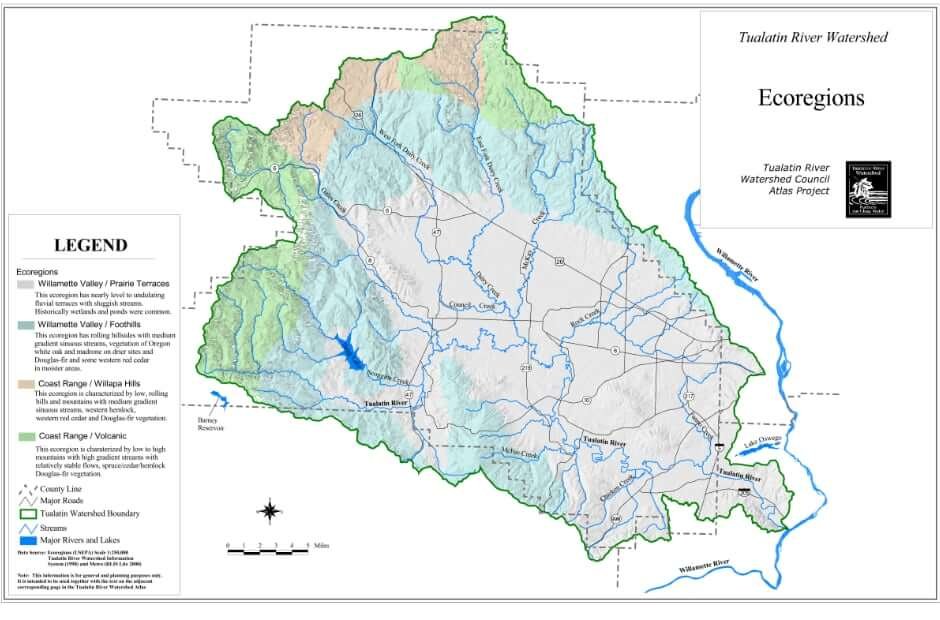
Eco Regions
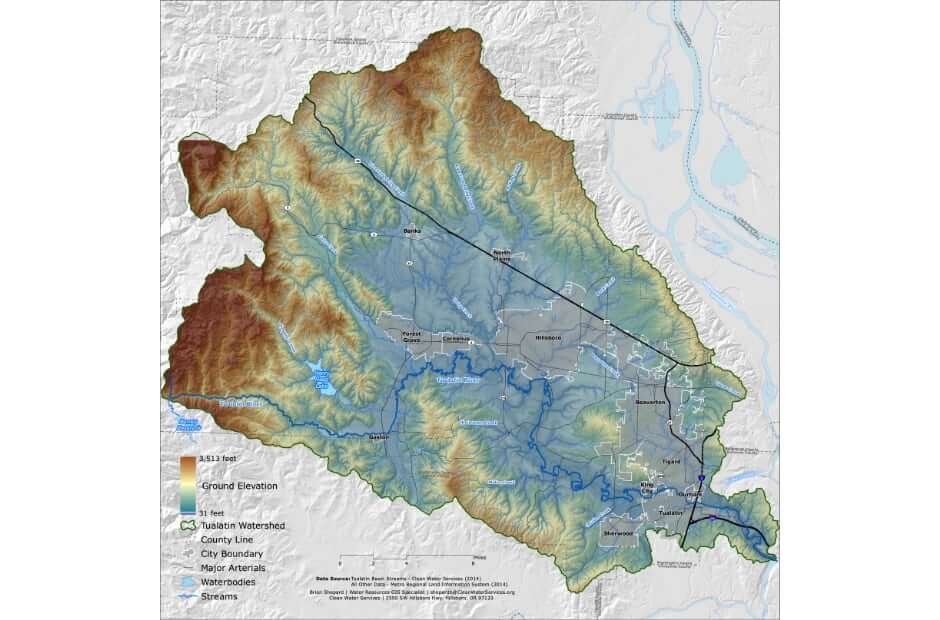
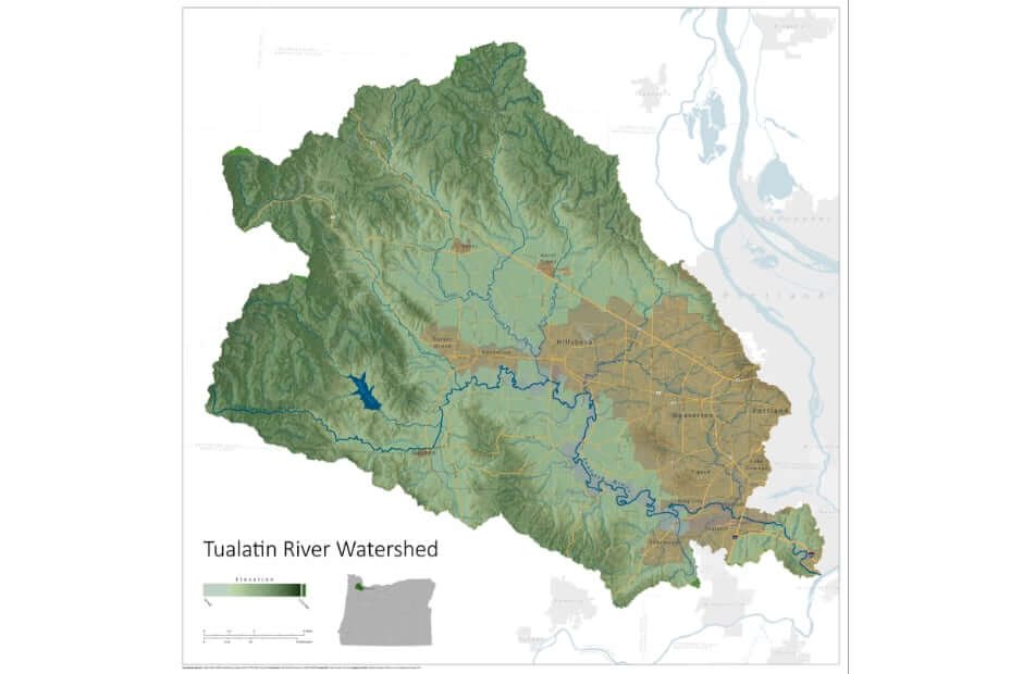
Elevation
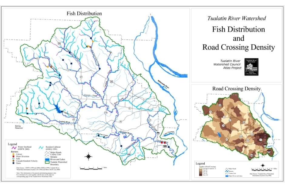
Fish Populations & Road Density
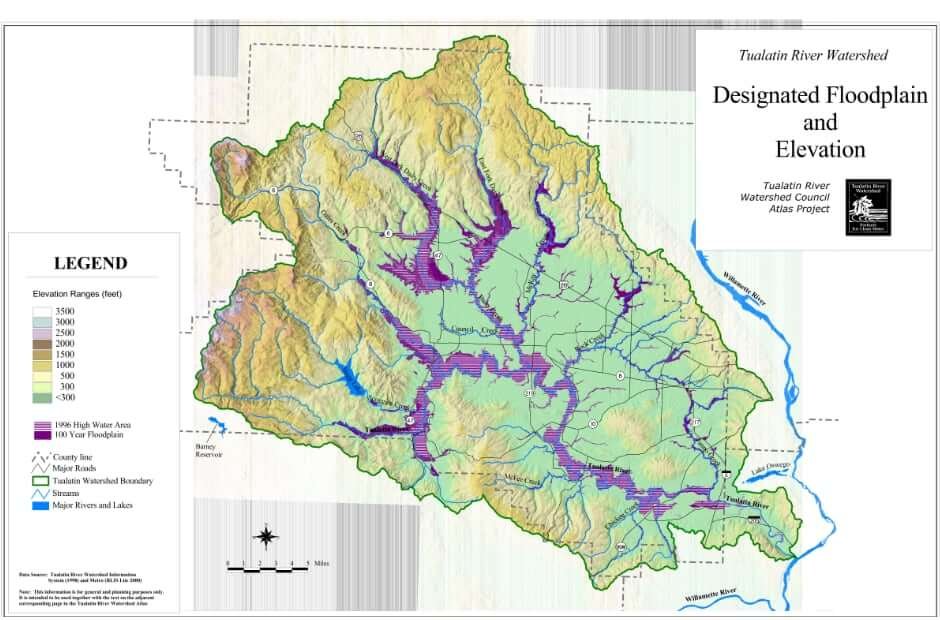
Floodplains & Elevations
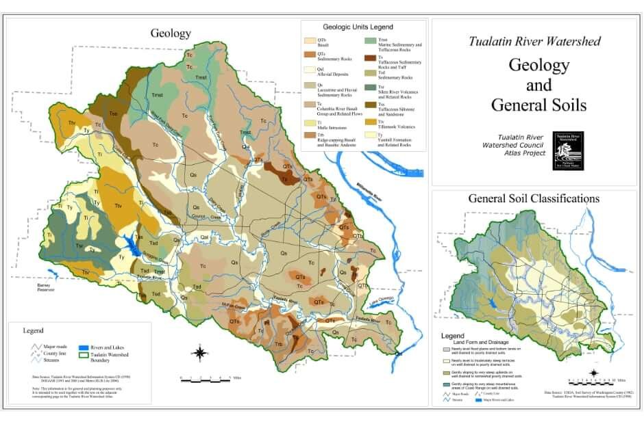
Geology & General Soil Classifications
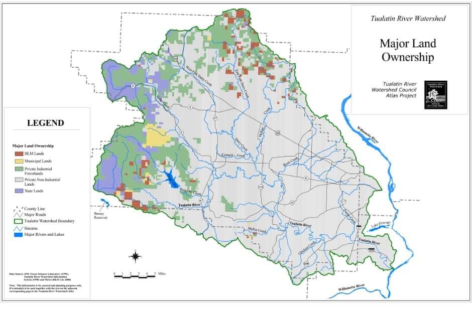
Land Ownership
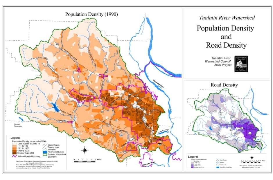
Population Density & Road Density
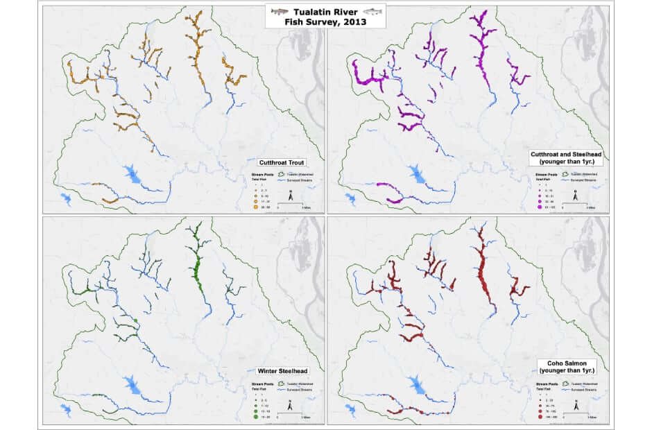
Rapid Bio-Assessment Snorkel Survey Results
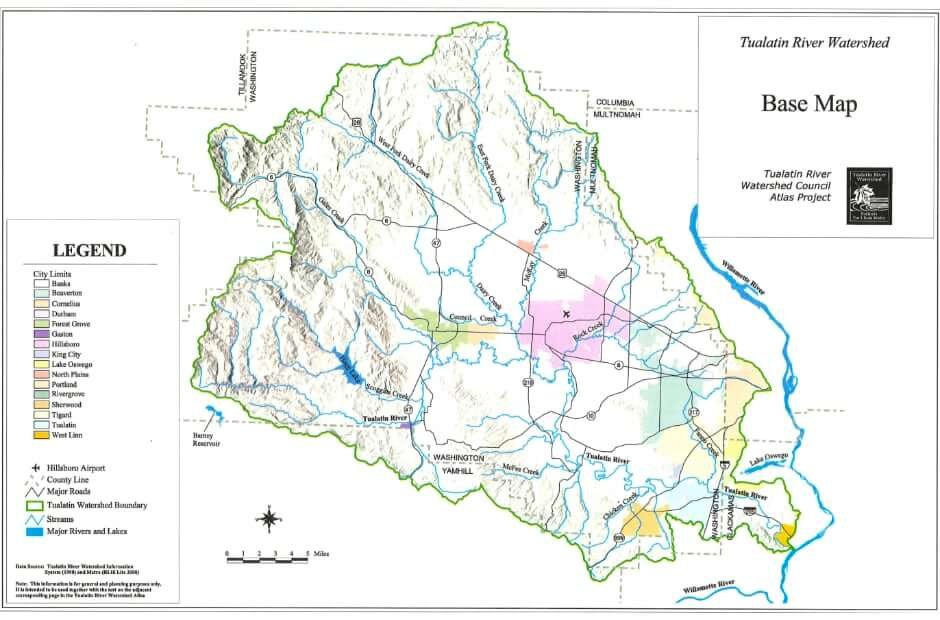
Tualatin Basin Cities
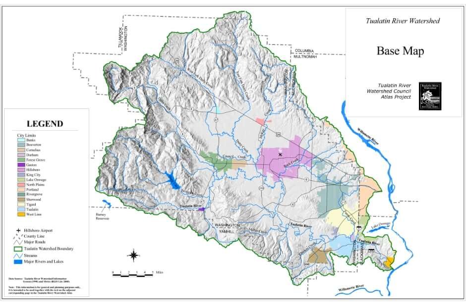
Tualatin River Watershed Map
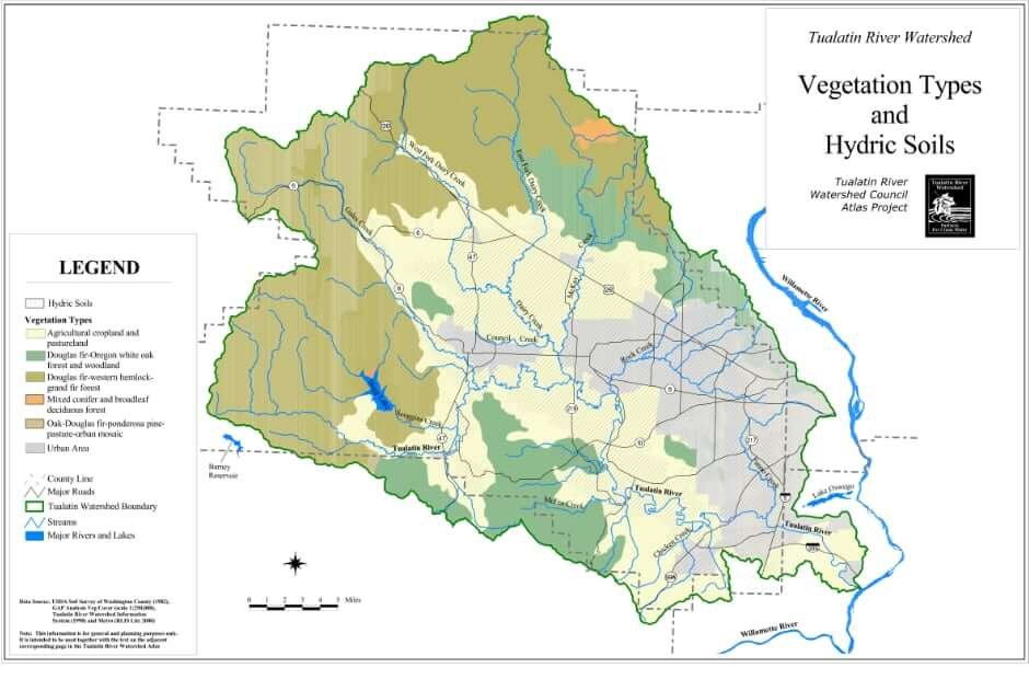
Vegetation Type & Hydric Soils
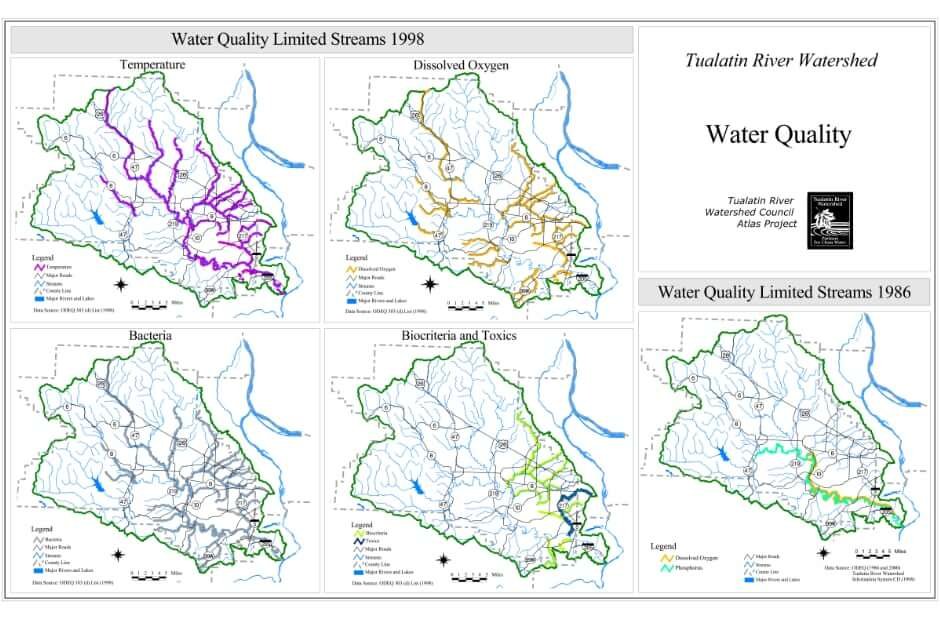
Water Quality
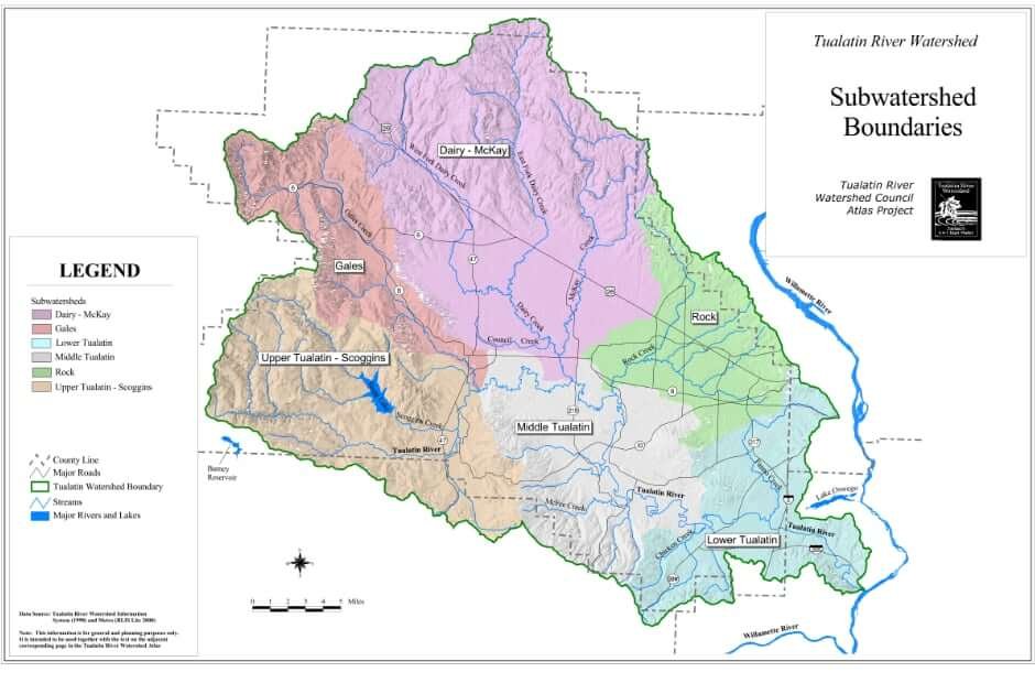
Watersheds
Watershed Atlas
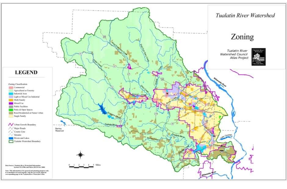
Zoning